
Build-Your-Own Mike’s Hike: Friday, November 29th
Day of Action Themed Hike
In the spirit of #OptOutside, WSCC is presenting the opportunity for everyone that is interested to “Build Your Own” Mike’s Hike. Whether you‘re staying in the North Fork Valley, or traveling to spend Thanksgiving with family, sign up as a trip leader for your very own hike. Get your family and friends to join you. Visit an area that your family hikes around every year. The trip could be nothing more than going to the local park and taking a very short stroll; or of course you could climb Mt. Sopris if that is your desire.
Description: In lieu of shopping all day at the shopping mall, join WSCC members and fellow hikers on an enjoyable hike wherever you may be on Black Friday. Use the flier below to help guide you on developing your trip. Don’t forget to to tag us on Facebook, and stop by the Conservation Center to claim your prize when your done!
Check out REI’s nationwide day of action and challenge to #OptOutside as well!
As an example of a Build Your Own Mike’s Hike, see below. Come up with your own idea, try to get friends and family members to join you, and let WSCC know of your hike when you get back:
Trip Leader: Mike Burkley
Where: Prairie Oaks Metro Parks in West Jefferson, OH.
When: 11/29. Time to be determined at a later date, but around Noon. Meet at Picnic shelter between Darby Bend Lakes.
Special Guest: Walter Burkley, just after celebrating his 94th birthday. And his wife, soon to be celebrating her 89th birthday.
Description: We’ll walk 1/2 mile one-way along the Darby Creek Greenway Trail to the bridge over the creek. We’ll either continue walking further or turn back to the car from there.
Prairie Oaks features nearly 500 acres of lush flowering prairies and grasslands that were restored using seeds native to the Darby Plains. The spectacular scenery of the Big Darby State and National Scenic River, which flows through the 2,203-acre park, provides a beautiful backdrop for outdoor adventure. Park also has several deep lakes for fishing and boating.
About the area: This Creek is listed as a State and National Scenic River. Yet there is a 369-acre housing development proposed at Roberts and Alton Darby Creek roads just south of where we’ll be walking in this Metro Park. More then 1,100 single-family houses and apartments in the Big Darby Creek watershed is part of this proposal. Dogs are allowed – as long as on leash.
Camel Back Wilderness Study Area, Roubideau Canyon: Monday, October 28th
Geology Themed Hike
Uncompahgre Field Office
Trip Leader: Mike Burkley.
RSVP is required for this hike, since the group size limit for this area is 12 people. PLEASE RSVP TO Mike Burkley at [email protected]
Price: Free, as always!
Meet at WSCC office 204 Poplar Ave in Paonia at 8:00 a.m. We can then carpool to Safeway Grocery Store in Delta if any Hotchkiss or Delta residents sign up for hike. We should arrive at the Delta Safeway between 8:45 and 9:00 am.
Description: From Paonia, it is approximately a 1 hour drive. Just west of Delta we drive into the eastern low desert country of the Uncompahgre Plateau. The last 6 miles of the drive is along the Roubideau Canyon dirt road, which is a little bumpy and rocky but not too rough.
Last year when we did a Mike’s Hike in this area, as we drove to the trailhead we saw a Pronghorn Antelope just off to our right, about 30 feet along the rocky hillside. And along the hike, we also saw the distinctive sign of recent Bear paw prints.
The first ½ mile of the hike is along an old Jeep road that parallels the Roubideau Creek. The creek was totally dry last year during the summer – but when I drove out here in May the creek was raging and I did not attempt to cross it on foot. The starting elevation is 5,200, and the canyon walls rise about 500 feet above the canyon floor. Last year, Geologists Dave Noe gave us a brief talk on the rock formations in this canyon – the lower layer being the Morrison Formation and the top layer the Burro Canyon formation. He mentioned that both of these rock types were very promising for finding dinosaur tracks, and for us to be on the lookout for certain tell-tale signs of possible tracks. The Morrison formation, especially along the front range of the Rockies near the town of Morrison, is known for its extensive dinosaur tracks discoveries.
After this ½ mile of hiking we will come to where the old Jeep road crosses over the creek. Here our group has two choices. One, we could continue along the canyon bottom along some foot paths – going in and out of the dry creek bed for as long as a hiker would desire. Or you could cross the creek on the road and continue on the other side and begin a climb to the mesas above. Our hiking group can vote on which way we travel when we come to this spot in the canyon.
On last year’s Mike’s Hike, we climbed the jeep road to the top of the mesa. We spotted large dinosaur prints just off the trail about half way up to the mesa. We probably wouldn’t have stumbled upon these prints if we had not gotten off the road and scrambled up a pretty steep and loose hillside. There were many other interesting fossils and mysterious items etched into various rocks.
The top of Winter Mesa is about 6000 ft, and if we chose to hike the high road we can bushwhack over towards the rim above Roubideau Canyon. This is Pinyon Pines and Juniper high desert terrain – with very large and healthy Rabbit Brush and Sage Brush.
From here we have just spectacular views. From north to south – Grand Mesa, the Badlands, the mesas above the North Fork Valley, The Raggeds, The West Elks including Mt. Lamborn/Lands End peaks; the rims along the Gunnison River Gorge, Black Mesa, and the San Juan Mountains (including Uncompahgre and Wetterhorn Peaks and Mt. Sneffels).
Instead of hiking to the top of Winter Mesa, if we take the lower route we will stay in the canyon bottom of Roubideau. This will involve a much less elevation gain, but perhaps more rock hopping along the dry creek bed. We can hike as far as we want, until it’s time to return the way we came.
About the area: Wilderness Study Areas (commonly known as WSAs) are places that have wilderness characteristics; that is naturalness, an untrammeled nature, and outstanding opportunities for primitive and unconfined recreation which make them eligible for designation as wilderness.
Camel Back Wilderness Study Area is a remote spot that provides nothing but solitude. This WSA was inventoried by the BLM for WSA in 1980 – and thus is considered to have characteristics of Wilderness. But it has not been officially designated as Wilderness by Congress. A few years ago, the Uncompahgre BLM office recommended that Camel Back be released as a WSA.
This WSA is characterized by a series of deep canyons and extensive mesa, sculptured by streams that cut canyons with massive cliffs, talus slopes, and isolated mesas and buttes. Vegetation consists of cactus, cottonwoods, pinyon-junipers, etc..
Total Acres is 10,735, and was designated as a Wilderness Study Area in 1980.
See some descriptions of completed hikes below!
Clear Fork of Muddy Creek: Monday, September 23rd
Hike through areas proposed for oil and gas development
Gunnison National Forest
Trip Leader: Mike Burkley
Price: Free, as always! Please RSVP to [email protected]
Where to meet: Meet at WSCC office 204 Poplar Ave in Paonia at 8:00 a.m on Monday 9/23
Description: We’ll drive up HWY 133 to FR 265. The first seven miles is along private land, a pastoral setting along the Muddy Creek with a few ranches and small farms spread along the way. After those seven miles we enter the National Forest boundary, and a few miles later we turn onto FR 844. In four miles we arrive at the trailhead.
From the trailhead we’ll hike along the Clear Fork trail (FT #810). The first 1 mile goes into a restricted area that contains a road to a natural gas well. After this easy 1 mile, we’ll leave this road where the trail follows the Clear Fork Creek. The trail is a gradual easy climb starting in brush country with mostly cottonwood and spruce trees along the creek bottom. There is a small grove of Ponderosa Pine trees not far from the trailhead (see photo below). Some open parks and meadows are found along the route. Along the trail we may encounter deer and elk – and the first time I hiked this trail I saw 4 Golden Eagles. We’ll hike approximately 4-5 miles before turning back the way we came.
Difficulty: Moderate- strenuous hike with a good elevation gain. Starting elevation is 7400 feet and highest elevation on our hike will be just over 9000 feet. One way hike anywhere from 4-5 mile – depending on how the group progresses.
What to bring: Be sure to bring plenty of water, sun screen, warm layers due to higher elevation, hiking poles (for possible creek crossings), and snacks and lunch.
About the area: This hike gets very little use due to its remoteness. The Clear Fork, true to its name, is a crystal clear stream that flows into the Muddy Creek about ½ mile south of the trailhead. At this confluence of the branches, the Muddy is true to its name – usually silty. Even though the Clear Fork has a larger flow, where they merge the Muddy takes over from there and continues its silty composition. The area is one of major headwaters of the North Fork Valley watershed.
There is some oil and gas activity currently in this drainage, and perhaps much more to come in the near future. We’ll be able to see at least some evidence of that development. This area is just north of the Bull Mountain Unit Master Development Plan and North Fork Mancos Master Development Plan, among others.
Little Elk Basin: Monday, September 2nd
Wilderness Themed Hike
Gunnison National Forest
Trip Leader: Mike Burkley.
Price: Free, as always!
Meet at WSCC office 204 Poplar Ave in Paonia at 8:00 a.m.
Description: We’ll drive towards Needle Rock, to the Inter Ocean Pass Trailhead. From the Forest Boundary on Little Coal Creek Jeep Trail, the final 1.7 miles to the parking area is a 4-Wheel Drive and High Clearance road. So if you have a 4-wheel drive vehicle, we’ll be looking for volunteer drivers.
Moderate-Strenuous hike with a good elevation gain. Starting elevation is 7500 feet and highest elevation on our hike will be 9500-10,000 feet. One way hike anywhere from 3-5 mile.
From the trailhead will hike along Inter-Ocean Pass Trail (FT#890) 1 mile with a moderate elevation gain to the junction with Little Elk Basin Trail (FT# 892). From there we’ll climb east along this Little Elk Basin Trail until we’ve had enough of the steep, rapid climb. We’ll be hiking through aspen forest to the top of Second Creek Ridge which contours around a south facing slope that is covered with sparse timber and brush. This portion of the trail allows good views of a big area to the south and west and enters into the West Elk Wilderness Area. This will be as far as we will get.
Be sure to bring plenty of water, sun screen, warm layers due to higher elevation, hiking poles (for possible creek crossings), and snacks and lunch.
About the area: The Gunnison Public Land Initiative (GPLI) as well as WSCC recommends the Mt. Lamborn-Coal Mountain area to be an addition to the West Elk Wilderness Area. The trail we hike borders the southern portion of this recommended wilderness area. In the 2018 GMUG USFS Wilderness Evaluation, the Forest Service evaluated 8,643 of these acres as HIGH degree of wilderness characteristics. Yet in the GMUG Draft Plan that was released June 2019, this area was not included as recommended wilderness.
Due to its remote location, high-quality habitat, and wilderness character, the GPLI considered this area for Wilderness designation. It contains populations of Colorado River cutthroat trout, water supply for the Town of Paonia, winter range for elk and migration corridors for mule deer and a high concentration for black bear.
Hubbard Park: Friday, August 30th
Forest Ecology Themed Hike
Gunnison National Forest
Please RSVP for this hike!
RSVP at 970-527-5307 or email Ben at [email protected]
Date: 8/30, 9 AM to 3 PM
Meet at 830AM at the WSCC Office, 204 Poplar, Paonia CO
Trip Leader: Robin Nicholoff
Theme: Forest Ecology, Silviculture, and Local Timber Sales
Trailhead: This hike will be a combination of Forest Road, trail, and off-trail hiking. Please make sure you come prepared for these types of travel.
Description: This Mike’s Hike will take us through an upcoming timber sale on the Gunnison National Forest. Joining us on the hike will be Cari Johnson, the Timber Management Assistant and Forester with the US Forest Service out of the Paonia Ranger District. This hike will give the public a chance to learn a bit about forest ecology and local silvicultural practices and see past and future timber harvests.
To begin, we will look at a birds-eye view of the Hubbard Park timber sale area using Google Earth at the Conservation Center office. This will give us an idea of the Hubbard Park timber sale area, and some things to keep in mind during our trip. We will also look at aerial images from the Cow Timber Sale, and what the forest looked like before and after timber harvesting.
From there, we will drive up Stephen’s Gulch Road, approximately a 30-40 minute drive from the Conservation Center, to the timber sale location. We will be walking roughly 3-4 miles total, on a mix of Forest Roads, trails, and bushwhacking, and stopping periodically to look at different prescription designations. The elevation of our hike will vary from 9200 ft to 10000 ft. We will then return to the Conservation Center around 3 PM.
When planning for this trip, please make sure to pack snacks, lunch, plenty of water, hiking poles (if you use them), sunscreen, and bug spray.
About the area: As part of the multiple use mission of the US Forest Service, forest managers have looked to timber harvesting on our National Forests as a way to stimulate the local economy, protect urban areas from the threat of wildfire, and enhance wildlife habitats within our National Forests. More recently, spruce beetle, sudden aspen decline, and other diseases affecting our forests have become increasingly important issues, challenging forest managers to balance harvesting trees with other non-extractive resources.
Terror Trail: Sunday, July 7th
Wildflower Themed Hike
Gunnison National Forest
Details: Trip Leader – Allison Elliot will identify the many Wildflowers along the trail. Meet at WSCC office 204 Poplar Ave in Paonia at 8:00 am
Price: Free as always!
Description: We’ll drive above the Paonia Reservoir and turn left from the highway onto Forest Road 265 towards Collbran. The first 7 miles is private property along the Muddy Creek, passing ranches and the beautiful Muddy Creek Valley. Another 6 miles or so is in the National Forest. But along the way is visible evidence of a few Drilling Pads and Energy Company stations, and a few miles to the south of our ride is Bull Mountain where 100+ Gas/Oil wells have been approved for drilling. One can only imagine what this Muddy Creek Valley would look like with all that drilling activity and numerous large trucks going back and forth along this scenic and quite forest road.
We leave FR 265 and travel south on lesser used Forest Road 704 for about 4 miles to the trailhead.
This is a moderate hike with a few elevation gains and losses. Starting elevation is 8700 feet and highest elevation 9500. One way hike anywhere from 3-4 miles one way.
Forest Road 704 is just on the eastern border of the Electric Mountain to the west; and to the east is the West Muddy Creek and Bull Mountain private land. If one would continue south past our Terror Trail East Trailhead you would pass first Poison Park and then Condemn-It Park. “Terror”, “Poison”, and “Condemn-It”; hopefully these names won’t frighten away interested hikers, those names are not indicative of how wonderful this trail with all its wildflowers will be.
From the Trailhead, we’ll immediately climb about 300 feet in the first ½ mile. There will be a few clearings in the trees to allow views of the far off West Elk Mountains. The rest of the hike will be in spruce trees and aspens, involving a few gentle climbs. We’ll hike perhaps 3-4 miles one way, until it’s time to turn back. On a Mike’s Hike last year on this trail, we came upon a Porcupine about 15 feet from us. He scurried up a tree 20 feet above the ground. On the way back, he was still in the exact spot up the tree.
The theme for this hike is to have Trip Leader Allison Elliott, with her botanist experience, point out each species of the multitude of wildflowers. She will also try to provide some interesting information about many of them. Here’s a list of many that she was able to identify on last year’s hike along this trail:
- Lupine
- Penstemon
- Columbine
- Indian Paint Brush
- Arnica
- Peas
- Mules Ear
- Skunk Cabbage
- Beards Tongue
- Choke Cherry
- Populus Tremuloides (Aspen)
- Thalictrum
- Larkspur
- Mountain Blue Bells
- Service Berry
On last year’s hike as we were half way up the climb, one of the hikers was quoted as saying – ‘’It is a privilege to be able to wander in these forests. ” It can’t put in any better words. Other than to add that this 3 mile stretch of the quiet Forest Trail in the Electric Mountain Recommended Wilderness area certainly has all the qualities for wilderness consideration.
Be sure to bring plenty of water, sun screen, warm layers due to higher elevation, hiking poles (for possible creek crossings), and snacks and lunch.
About the Area: WSCC, along with the Wilderness Coalition, recommends Wilderness designation for Electric Mountain. This 9,700 acre area is dominated by undisturbed rolling aspens and spruce-fir forests and provides summer habitat for herds of deer and elk, providing for the primary recreational activity during fall hunting season. It also provides outstanding opportunities for solitude because of its roadless and non-motorized management. If one was to hike far enough from this hike’s trailhead or from the Hubbard Park’s Terror Trailhead, you can achieve outstanding views of the North Fork Valley, West Elk Mountains, and Ragged Mountains.
Buzzard Park Trail: Sunday, June 23rd
Photography Themed Hike
Gunnison National Forest
Details: Trip Leader – Nicholas Turner will provide tips in Nature Photography. We will meet at WSCC office 204 Poplar Ave in Paonia
Price: Free as always!
Description: We’ll drive up Stevens Gulch, past the turnoff for Overland Reservoir and continue to FR265. From there, we’ll cross the Delta-Mesa County line a couple miles to the trailhead. It is a little over an hour drive to the trailhead. At the Mesa County line, you are at the Muddy Creek-Buzzard Creek Divide. To the south the drainages eventually flow into the North Fork of the Gunnison. To the north, they eventually flow into the Colorado River.
This is a moderate hike with a few elevation gains and losses. Starting elevation is 8700 feet and highest elevation 9500. One way hike anywhere from 3-4 miles one way.
The trail travels through aspen and meadows in the Buzzard Creek drainage until it climbs away from Buzzard Creek and then descends into the Bird Creek drainage. It crosses several times through meadows until it climbs the hilltop into Buzzard Park. From here there is a scenic view of the West Elk Mountains, and far away to the east, you could also make out the Elk Mountains – Capitol Peak and Snowmass Peak, both 14’ers (see photo below). As long as we can make the Bird Creek crossing, Buzzard Park will be our hopeful destination for the hike.
This trail permits mountain bikes and ATVs. Last year, three of us who did this hike agreed that the rugged land to the south, which is the northern portion of the Chalk Mountain area, certainly deserved wilderness protection.
Be sure to bring plenty of water, sun screen, warm layers due to higher elevation, hiking poles (for possible creek crossings), and snacks and lunch.
About the Area: The Buzzard Park Trail forms the northern border of what WSCC has recommended for wilderness in the Chalk Mountain area. If you take this trail approximately 6 miles westward, you come to Willow Creek. There, the Monument Trail skirts along this creek, and it more or less forms the northwestern boundary of Chalk Mountain Recommended Wilderness that we have included in the Community Conservation Proposal, a citizen-led proposal we are working to get included in the GMUG Draft Forest Plan. The southern portion of Chalk Mountain area is near the Overland Reservoir and the FR705 that takes you to that reservoir. This hike will not come close to Willow Creek.
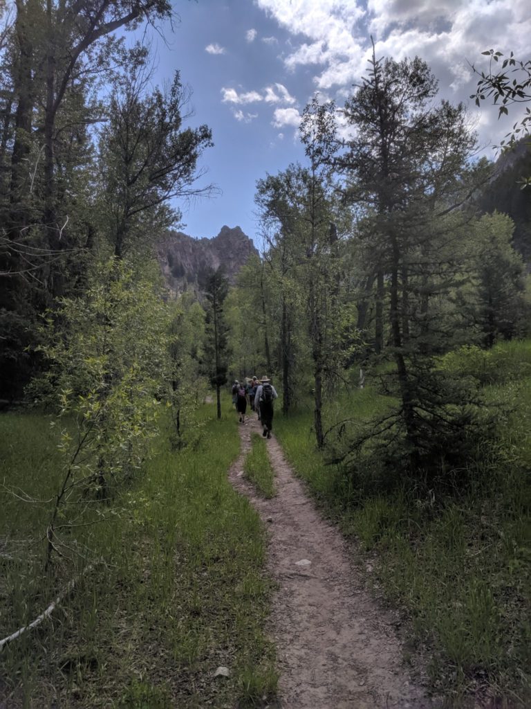
Munsey Ruby Stock Driveway Trail: Monday, June 3rd
Raggeds Wilderness and Dark Canyon Hike
Gunnison National Forest
De-brief of the hike and trail report:
Having no idea what the trail conditions would be at the Erickson Springs Trailhead off Kebler Pass Road, the 8 of us met at the trailhead. We hoped to hike up the Munsey-Ruby Stock Trail off the Dark Canyon of the Anthracite Creek. This trail would take us up along the part of the land that is included in the Colorado Outdoor Recreation and Economic Act (CORE).
This Act has been introduced earlier this year by Senator Michael Bennet and CO US Representative Joe Neguse. The CORE Act would permanently withdraw 200,000 acres ranging from near Carbondale down to Kebler Pass from future oil and gas development, while preserving existing private property rights for leaseholders and landowners. WSCC is encouraging all members to send comments to Senator Cory Gardner, who is not in support of the CORE Act.
This was the reason we chose to hike the Munsey Ruby Stock Trail. Before we left for our hike, we had to lather up with tick repellent due to the multitude of ticks along this trail. But more importantly, trip leader Mike Burkley read some appropriate quote from Edward Abbey and Republican President Teddy Roosevelt, about the importance of wilderness*.
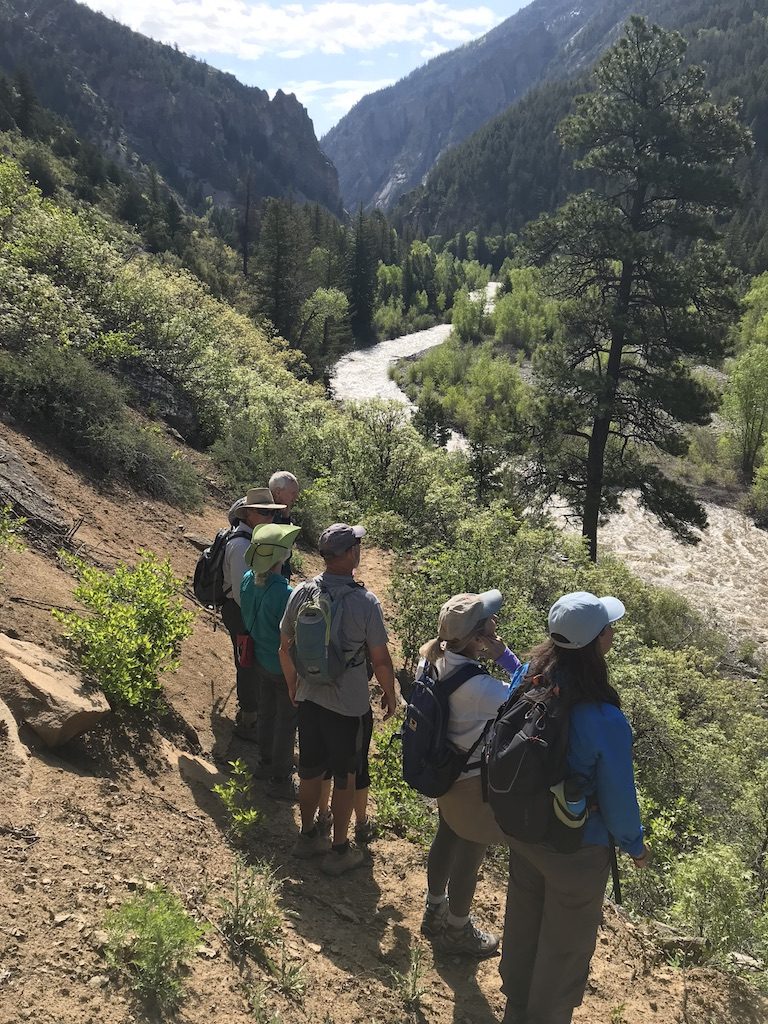
Crossing the bridge about ¼ mile from the trailhead, we marveled at how high and fast the Anthracite Creek raged below us. We then hiked on the seldom used Munsey Ruby Stock trail. It lead us to an open traverse about 100 feet above the creek which provided us with spectacular views up Dark Canyon with the creek below. We then dropped down to a level area past a private cabin. This is where the normally dry trail turned into a small creek. We continued as far as we could until we came to the banks of Munsey Creek. It had overcome its banks here and it had totally inundated the trail. We could go no further. So we turned back towards the main trail, but not before Lisa and Betsy had the chance to smell and hug a huge Ponderosa Pine Tree along the trial.
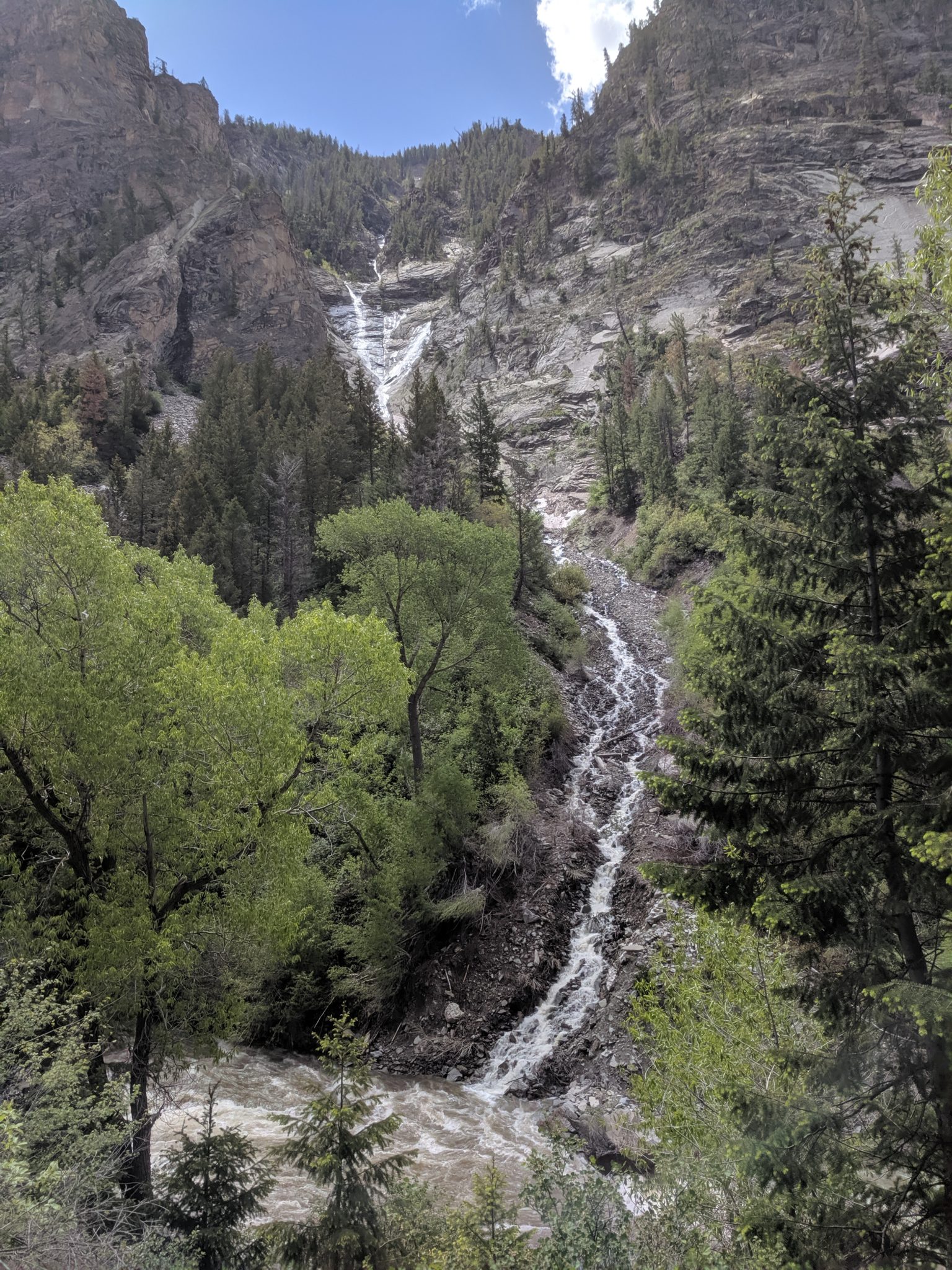
We ended up hiking up Dark Canyon and its trail, which took us immediately into the Raggeds Wilderness. Even though we had to abort Munsey Ruby Stock Trail, no one was disappointed in the 2 mile hike up this canyon. There were a number of places along the trail we had to try hard to avoid water that had overtaking the trail. There was one small creek crossing where we had to leap and slip across the water to the trail. But we mostly came out dry and unscathed.
The highlight of this hike, other than enjoying the company of all the fellow hikers, were the numerous waterfalls falling down from the cliffs above the main creek. These are only due to the heavy spring melt-off, they normally aren’t flowing. But there were two or three way up high on the opposite side of the creek – easily 300-400 feet above the Anthracite Creek. This was one of the most spectacular ones on our side, and we heard one hiker comment these reminded them of the famed Yosemite Falls (which is one of the tallest falls in North America), minus the hundreds of tourists.
We arrived back at the trailhead just before storms hit the North Fork Valley. We did have a few sprinkles, and heard some thunder, and saw dark skies. A couple of us had to pick off a couple of ticks along the trial, and at the cars after the hike we all did a thorough examination to get rid of all the ticks. But to quote Betsy, “this was a life changing hike”. There’s nothing else one can say after that statement. Other than to emphasize that this spectacular land outside the Raggeds and West Elk Wilderness, we need to write comments to Senator Gardner telling him how he must support the CORE Act and protect this area from oil and gas development. Also, we need to thank Senator Bennet and Representative Joe Neguse for their efforts in advancing this legislation through Congress.
* “Lying out at night under those giant Sequoias was like lying in a temple built by no hand of man, a temple grander than any human architect could by any possibility build, and I hope for the preservation of the groves of giant trees simply because it would be a shame to our civilization to let them disappear. “
The quote above was from a speech from in 1903 from President Roosevelt on his Glacier Point camp outing with John Muir. On 6/11/1906 President Roosevelt signed a bill designating the valley of Yosemite Valley and the Mariposa Grove a National Park.
“Wilderness is not a luxury but a necessity of the human spirit, and as vital to our lives as water and good bread.”
Edward Abbey
Description: Moderate-strenuous hike. The start of this hike is the Dark Canyon Trailhead at Erickson Springs. It’s a long, steady hike – at times quite steep and little shade. We’ll climb about 2,000 feet in elevation in 3.5 miles to spectacular overlooks. After the first mile from the trailhead, only hikers and horses are permitted – no motorized or mechanized vehicles allowed. Yet this whole area is outside The Raggeds Wilderness, although much of the way we will be within .25 to .50 miles on either side of the trail from designated wilderness.
Bring good hiking boots, poles, plenty of water, sunscreen, snacks and lunch. The area is known to have some ticks, but we should be out of tick range after about a half mile of hiking, once we get above the creek. Make sure to wear long pants and bring some bug spray as well!
About the Area: The Raggeds Wilderness was designated in 1980 along with the passage of the Colorado Wilderness Act of 1980. The area is known for it’s prominent rocky slopes and serrated ridges, which give this Wilderness area it’s well-deserved name.
See the pictures below from our hike!
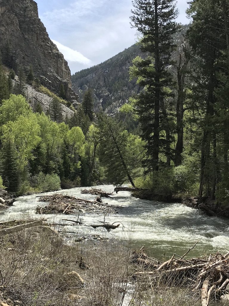
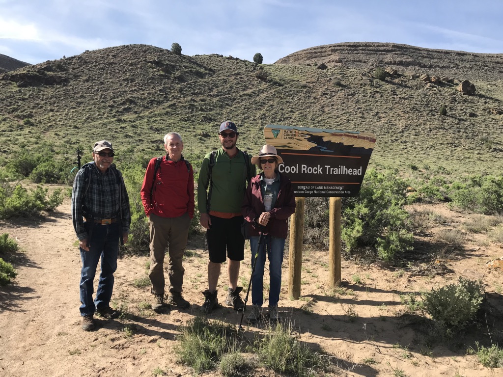
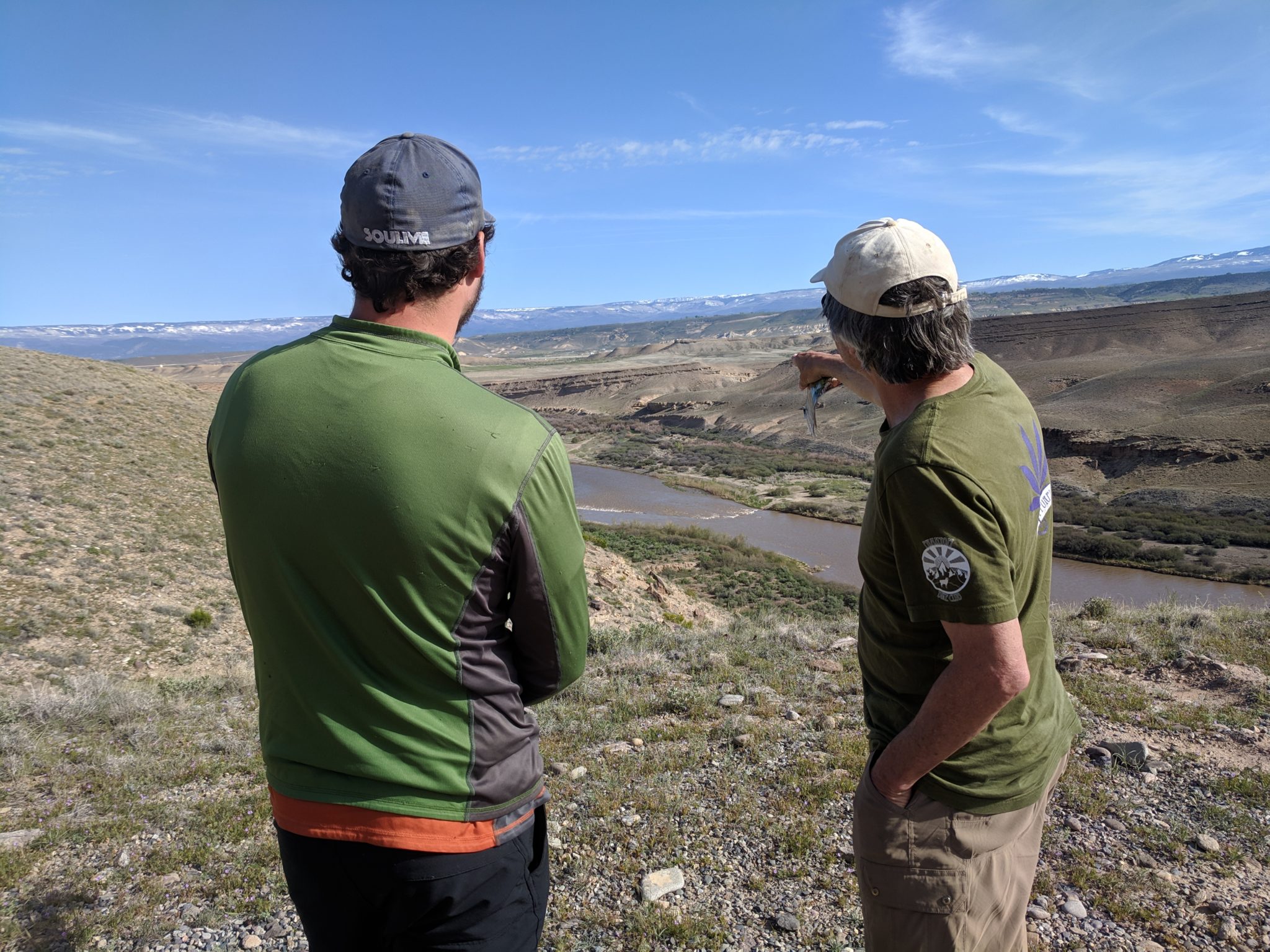
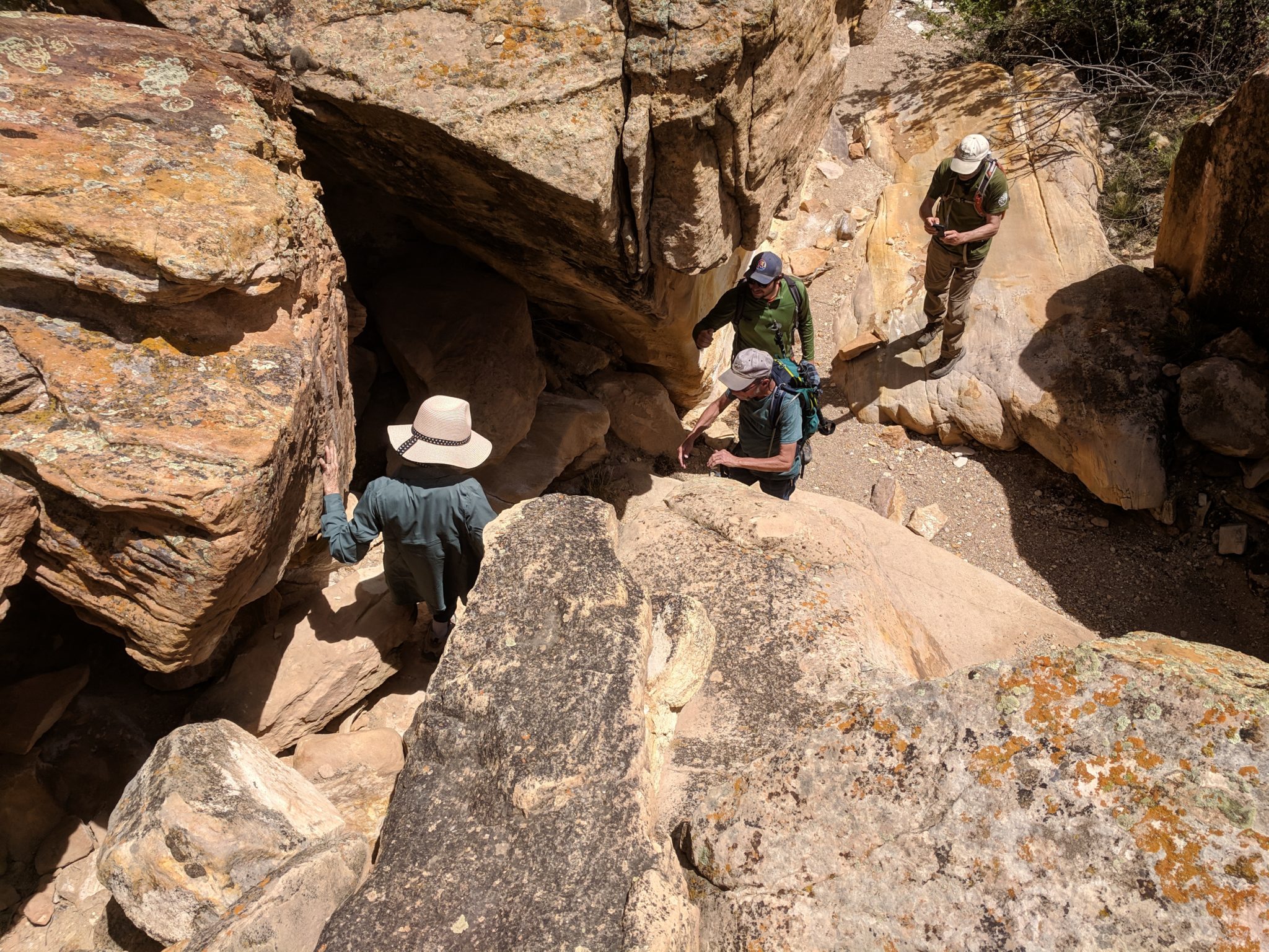
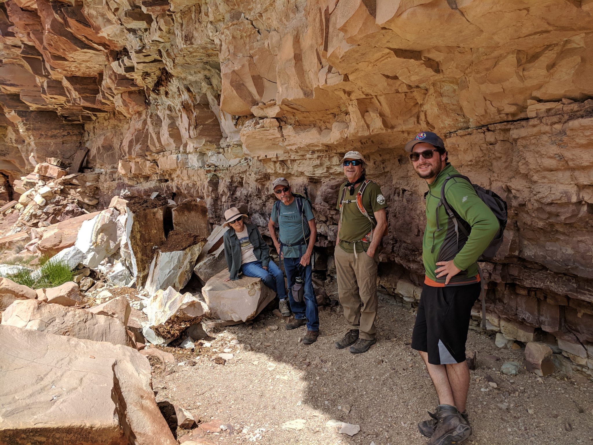
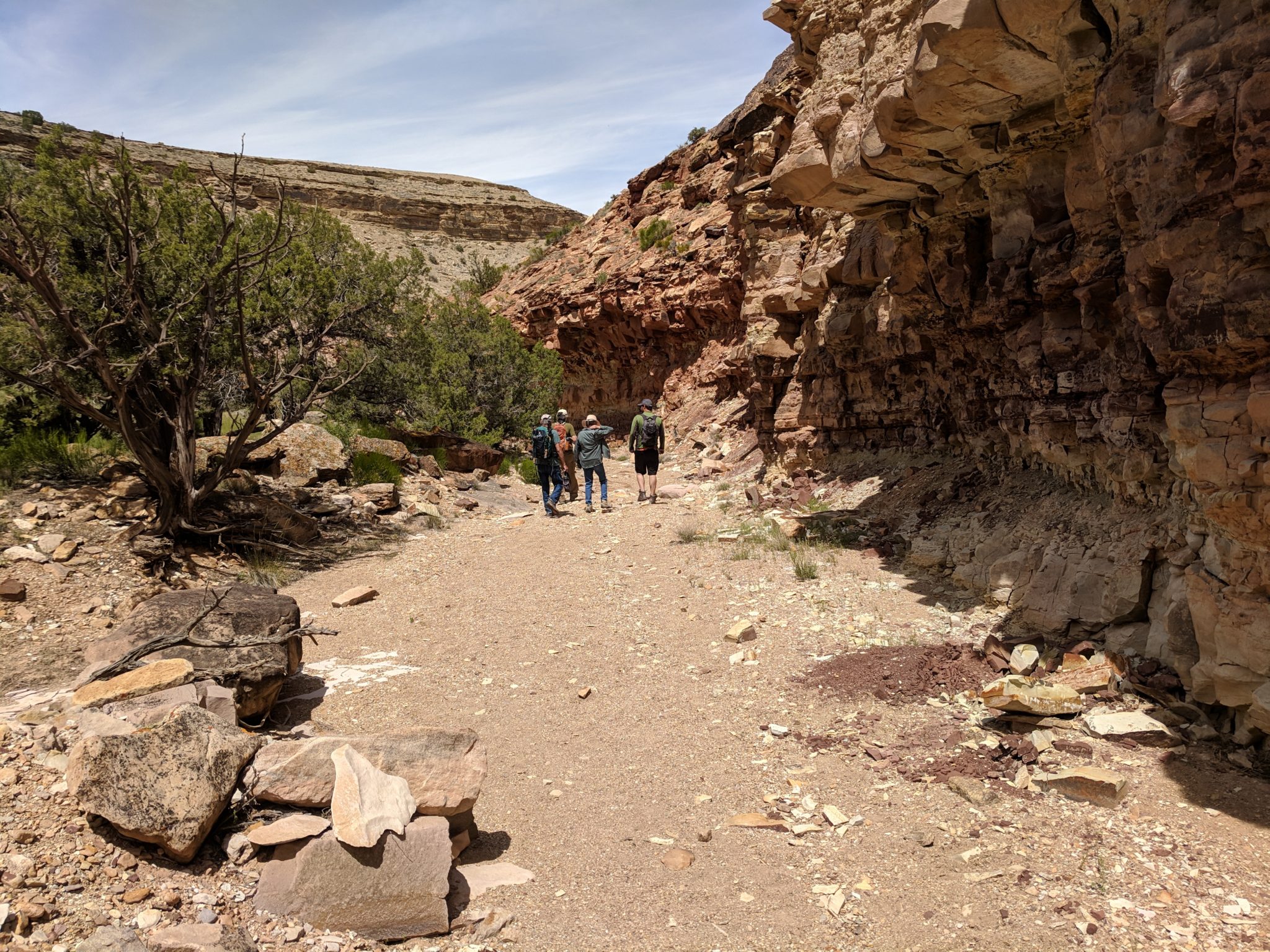
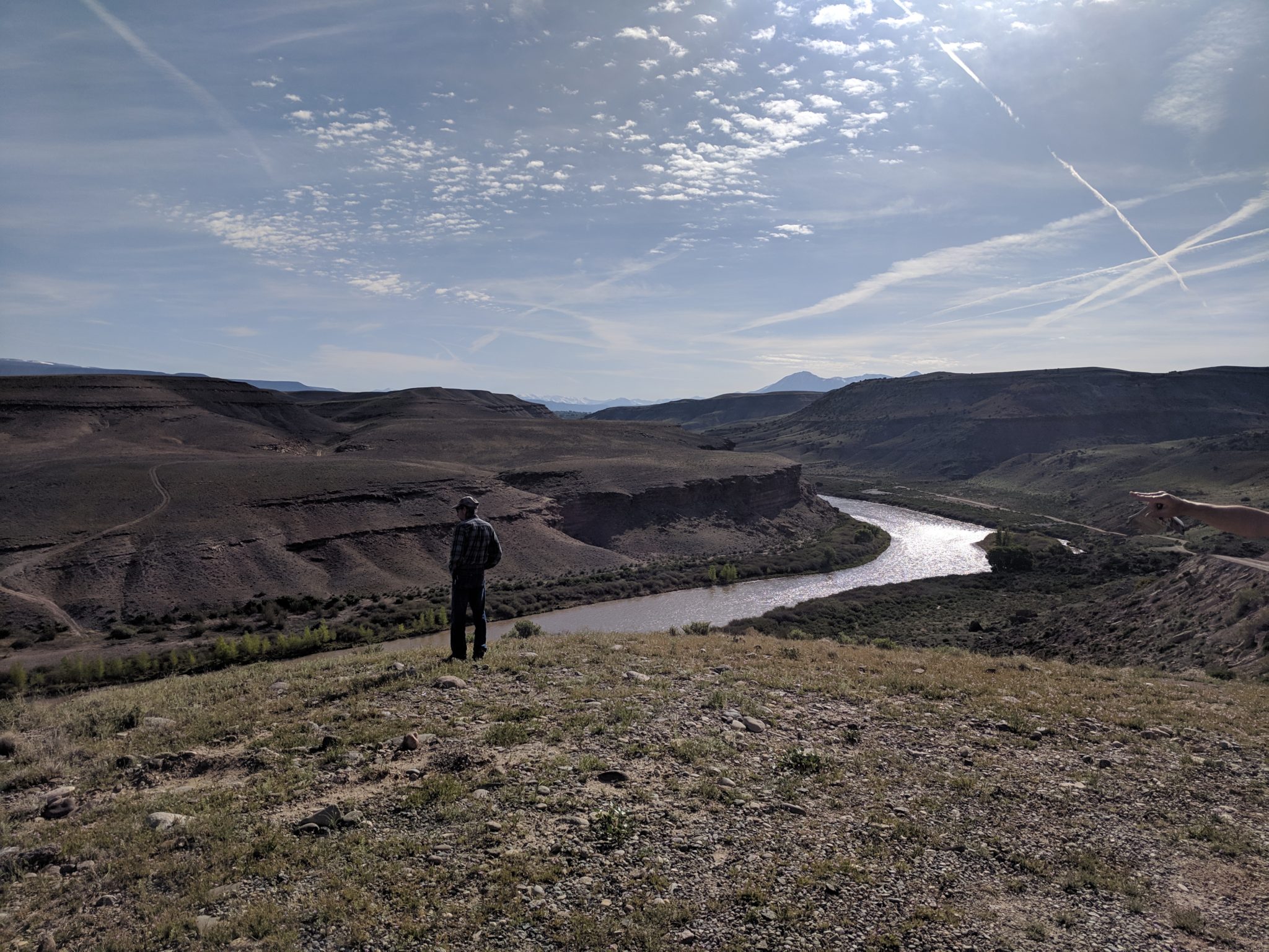
Cool Rock Canyon: Monday, May 6th
Cool Rock Canyon – Geology Hike
Gunnison Gorge National Conservation Area
De-brief of this hike: The Cool Rock Canyon trail winds through colorful sandstone canyon with interesting rock formations and fun places to explore. It is located on South River Road in the Gunnison Gorge NCA, just outside the designated Wilderness Area where only hiking and horseback riding is permitted. The 62,844 acre NCA encompasses diverse landscaping and is recognized for its geologic, scenic, wilderness and recreational resources.
Five of us left the trailhead along the Gunnison River. We started up a slope at the mouth of Cool Rock Canyon and dropped into the dry, gravelly wash. There is no trail, but it’s an easy to follow route straight up the wash – with minor rock hopping and a few boulders to climb up. We hiked about 2 ½ miles up the canyon to where we took our lunch break and decided to head back.
The theme for this outing was geology regarding the cool and unique formations in this canyon. We were walking through rocks that were formed 150-200 million years ago – mostly Sedimentary Rocks of the Entrada and Morrison Formation. Every turn and bend we made in the canyon brought us to a totally different view and type of rocks – sometime steep walls, large overhangs and ledges, or evidences of rock falls from who knows how many years or centuries ago.
This canyon was bone dry, and considering that the drive along South River Road took us along extremely arid terrain that had very little vegetation, one would not expect the beauty and ecology that we enjoyed in Cool Rock Canyon. There were plenty of wildflowers – purple thistles, globe mallow, desert cliff rose, and others that we weren’t able to identify. There were many junipers and some quite large blooming Mormon Tea bushes. The canyon was so quiet, not a sound other than the numerous birds, which included the sweet song of the Canyon Wren. The highlight may have been a few a few sightings of the large bright green and yellow- toed Collared Lizards.
See pictures below from our hike!
How to get there: Drive south from Austin to access the South River Rd (south of the Gunnison River). The South River Road is dirt and can be steep and rocky. It’s about an hour drive from Paonia.
This is a moderate hike. Starting elevation is 5100 feet and it is a moderate 2-3 mile hike one way; with ending elevation approximately 5600 feet.
About the Area: The Gunnison Gorge NCA is over 62,000 acres that was designated in 1999 by Congress. It is recognized for its outstanding geologic, scenic, and wilderness resources.
Hi there,
I understand that a hike is planned for May 4 to Elephant Hill. I most likely will be unable to attend, but would like to find out where the trail head is for this hike? I have not been able to find any information on Elephant Hill.
Thank you!
Hi Evelyn –
That hike is part of Dr. Dave Noe’s Earth Beneath Our Feet series. It is being run primarily by the library.
Here is a link to more information: https://deltalibraries.org/event/elephant-hill-geology-walk/
Evelyn, just seeing your post dated Apr 15, 2019 – 10 months late.
I love the hike up Elephant Hill and think we are fortunate to have it so close. I learned in the report associated with the Paonia geologic map (by Paonia resident Dr David Noe) that boulders on top of Elephant Hill probably were transported from Lamborn peak area during glaciation.
A trailhead is located near the intersection of Hidden Valley Drive, Hidden Mesa Lane and Ragged Mountain Drive. Park 60 yards uphill from this intersection on the right. Walk up toward the hilltop on the right (east) side of the road. Follow a rough 4wd road that includes fall line ascents with rocky footing. Alternately, depart from the 4wd road at steep rocky sections on game tracks back and forth for more comfortable footing, generally paralleling the 4wd road. There’s a high point at 6,800 ft, then descend to a saddle and up to the peak at 7056 ft. Views into both the Minnesota Creek and Miller Creek drainage. Excellent views of the Lone Cabin access road and of course Mt Lamborn and adjacent peaks.
Russ Z