In 2020, the Bureau of Land Management (BLM) Uncompahgre Field Office (UFO) approved a Resource Management Plan (RMP) for 675,800 acres of BLM-managed public land within the Lower Gunnison, Uncompahgre, and San Miguel watersheds and 971,220 acres of federal mineral estate. The Western Slope Environmental Center (WSCC) has worked for more than a decade to develop community based limits on oil and gas development in the North Fork Alternative. When the approved RMP opened the vast majority of our watershed to oil and gas development, WSCC filed our first ever lawsuit resulting in a settlement with the BLM. Under that agreement, BLM will amend the UFO RMP to reconsider decisions related to oil and gas leasing, Areas of Critical Environmental Concern (ACECs), and Lands with Wilderness Characteristics (LWCs).
WSCC has continued to work with our partners to update the North Fork Alternative and submit public comments to the BLM. In winter 2024/2025 the BLM will release their preferred alternatives for the RMP with a 90-day window for public comment.
The BLM has recently finalized several other land management planning efforts that will be incorporated into the UFO RMP. These include the Big Game Corridors RMP Amendment, Gunnison Sage Grouse RMP Amendment, and Western Solar RMP Amendment.

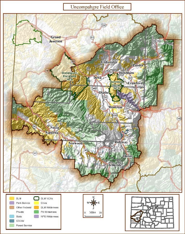
A Resource Management Plan (RMP) guides all projects and multiple-use activities within the Uncompahgre Field Office (UFO). The Uncompahgre Field Office (UFO) planning area is generally defined by the Utah border on the west, extends just south of Telluride, and stretches all the way up to Huntsman Ridge and McClure Pass. See the map to the left for a more detailed look at what is included within the UFO planning area.
Within the RMP decision area are 678,400 acres of BLM surface managed land, and 963,300 acres of sub-surface mineral estate, which includes federal mineral split-estate underlying private, city, and state owned lands. The BLM also manages the sub-surface estate for U.S. Forest Service (USFS) managed land. However, there is currently a moratorium on oil and gas leasing for the nearby Grand Mesa, Uncompahgre, and Gunnison (GMUG) National Forests, and future development would be subject to USFS consent. The GMUG National Forest, Gunnison Gorge National Conservation Area, Dominguez Escalante National Conservation Area, and Black Canyon of the Gunnison National Park are not part of the UFO decision area.
Please note that site-specific activities are not authorized by the UFO RMP, but where, when, and how things can happen is authorized. The decision area is the same as that analyzed for the 2020 RMP, although acres have changed slightly due to improvements in geospatial information.
The Uncompahgre Field Office (UFO) began the scoping process for the Resource Management Plan (RMP) on January 12, 2010. Since that time, the Western Slope Conservation Center (WSCC) has been participating every step of the way. During this process, WSCC, along with a collection of other groups including but not limited to Valley Organic Growers Association, the West Elk Winery Association and others, created the North Fork Alternative Plan (NFAP). The objective of submitting the NFAP to the BLM was to ensure that the agency considered its strongest levels of protections for the North Fork Valley’s public lands resources.
The National Environmental Policy Act (NEPA) requires federal agencies to examine the environmental consequences of proposed actions, consider alternatives, and engage the public in decisions that may impact human health or the environment. For a significant action like a Resource Management Plan, NEPA requires the BLM to complete an Environmental Impact Statement (EIS). The North Fork Alternative Plan was considered in the BLM’s UFO RMP EIS, making this the first community alternatives ever analyzed in a public lands management planning process.
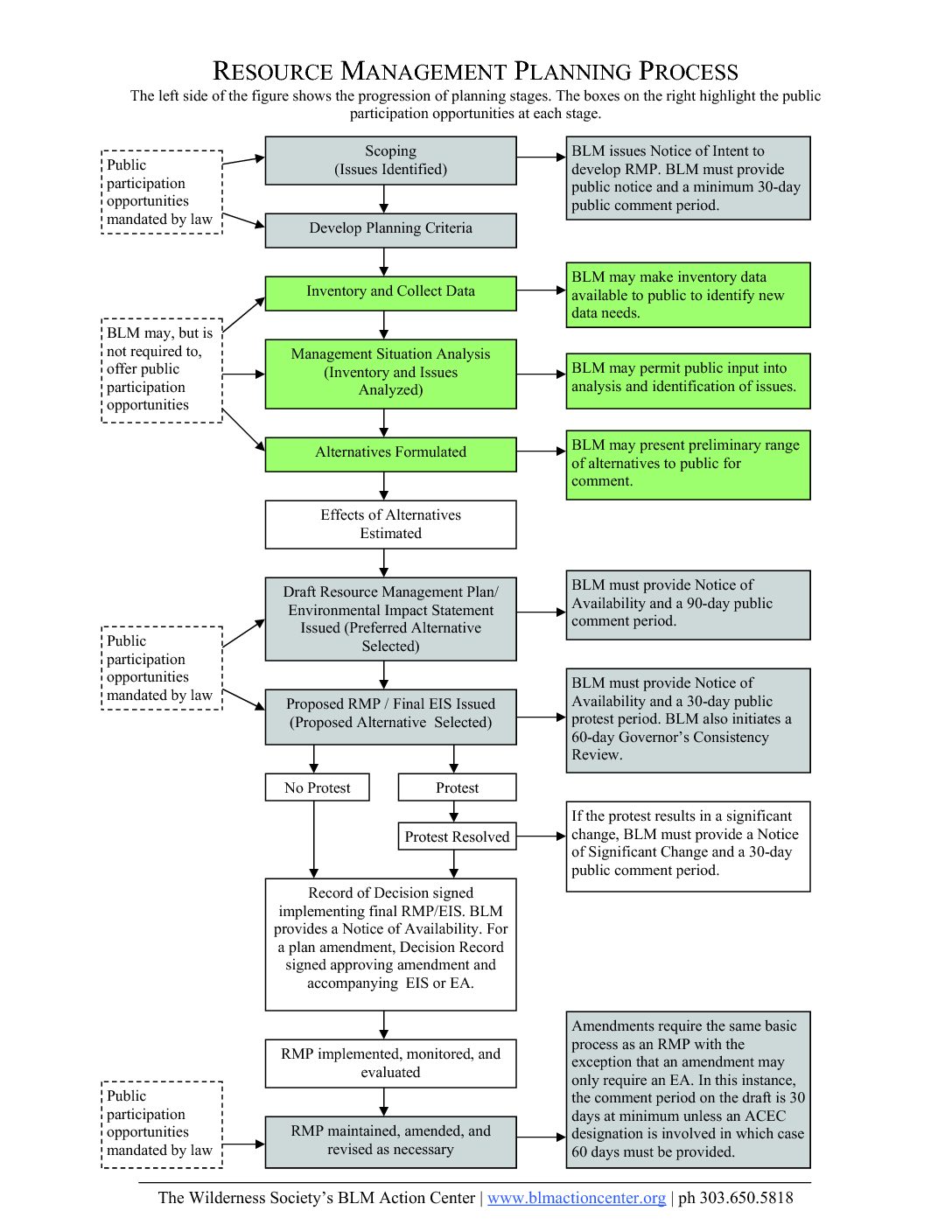
Looking at the graph to the right, you will notice the steps it takes to write a resource management plan of this nature. Also, please note the points throughout the process where the BLM is required by NEPA to ask the public for its participation. NEPA is a complex, intricate, and invaluable piece of legislation that fundamentally changed how government agencies act on our public lands.
To find out more about NEPA, please check out the Council of Environmental Quality’s (CEQ) website.
For a better look at the complexities of the process, take a look at the CEQ guide to NEPA here.
