
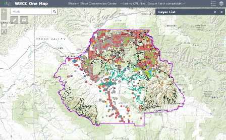
Use this interactive map to understand the local issues you are interested in–from irrigation to energy development. The data that is illustrated in these maps is accurate and reliable, and together they tell a story of conservation in Delta County. Some particularly interesting layers to explore include the COGCC Oil and Gas Wells, regional roadless areas and other Forest Service travel routes, and local irrigation ditches and diversions.
You can also access information about stream flow, snowpack, and drought on our Resources Page.
This interactive map was funded by the Bureau of Reclamation.
Click here to view and download the .kml files associated with this map.