
Renewable Energy on Public Lands
At the end of August, the Bureau of Land Management (BLM) released their final proposal to update the Western Solar Plan. It would make over 31 million acres of public lands across 11 western states available for potential solar development. The plan intends to focus solar applications within 15 miles of existing or proposed transmission lines (69kv lines and larger), or on previously disturbed lands not otherwise excluded (regardless of transmission proximity).
Exclusion areas were identified using resource-based exclusion criteria, and a general exclusion of lands with slope greater than 10%. There are 21 resource-based exclusion criteria including National Conservation Lands, Areas of Critical Environmental Concern, Lands with Wilderness Characteristics, and Critical Habitat for Threatened or Endangered Species, to name a few.
Two types of lands are available for solar applications, but designated for avoidance: (1) big game migration corridors (non-high-use); and (2) areas designated as avoidance for solar development in existing BLM land use plans. Any solar projects proposed in areas available for application are still subject to site-specific design features and project-level environmental review.
| State | BLM Planning Acres | Acres Available for Solar | Designated Avoidance Lands | Total Acres Available for Solar Applications | Total Exclusion Acres |
| Colorado | 8,342,232 | 467,956 | 126,178 | 594,134 | 7,748,099 |
Under BLM’s Reasonably Foreseeable Development Scenario approximately 700,000 acres of BLM land (of the 31 million acres identified as available) are likely to be developed for solar by 2045, representing as much as 75% of future solar energy development across the 11 western states. In Colorado, approximately 45,207 acres of BLM land could foreseeably be developed for utility-scale solar, with about 15,069 acres of solar development likely on non-BLM administered lands.
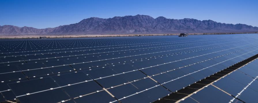
Developing renewable energy resources, like utility-scale solar on BLM lands, supports national climate priorities and renewable energy deployment goals for public lands as part of an economy-wide effort to reduce domestic greenhouse gas emissions, build a clean energy economy, and support meaningful global climate action. As of June 30, 2024, the BLM had permitted 31,580 megawatts (MW) of renewable energy capacity onshore. As of July 11, 2024, the BLM was processing 70 utility-scale clean energy projects proposed on public lands in the western United States with the combined potential to add another 32,000 MWs of renewable energy to the western electric grid.
Western Slope Conservation Center (WSCC) had commented on the BLM’s draft preferred alternative plan suggesting BLM only identify lands for solar application if they were both near transmission infrastructure and located on previously disturbed lands. WSCC also commented on issues including cumulative impacts, impacts to wildlife impacts, resource based exclusion criteria, and public engagement especially among frontline and Tribal communities.
Read WSCC’s comments HERE.
Locally, some BLM-managed lands that have been identified for solar applications include Delta County areas on either side of Highways 50, 92, and 133; the Roubideau Bench in Montrose County; the Uncompahgre Plateau in Ouray and Montrose counties; and the Dolores River Canyon landscape in Dolores, San Miguel, Montrose and Mesa counties.
A few local areas are highlighted below (Green are lands available for solar applications; Red are exclusion areas), but you can better explore the Western Solar Plan using BLM’s Interactive Mapping Tool.

The Elephant Hill area near Paonia, which WSCC had nominated for ACEC protections in the Uncompahgre Resource Management Plan, contains several areas identified for solar applications.
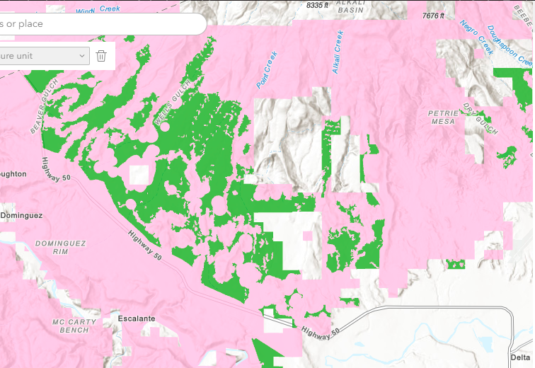
The Adobe Badlands, north of Delta, was also nominated by WSCC for ACEC protections. Proximity to a large transmission line and past impacts from off-highway vehicle use and grazing contributed to the identification of these areas for solar applications. Steep slopes contributed to the exclusion of intermingled areas.
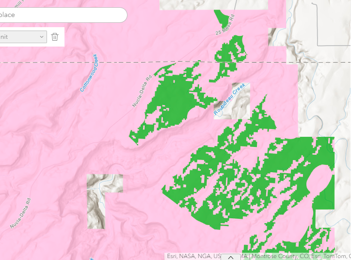
Near the beginning of 25 Mesa Rd (Delta-Nucla Rd) WSCC had nominated the Roubideau Canyons for ACEC protections. At the edge of this area the BLM identified the potential for solar development.