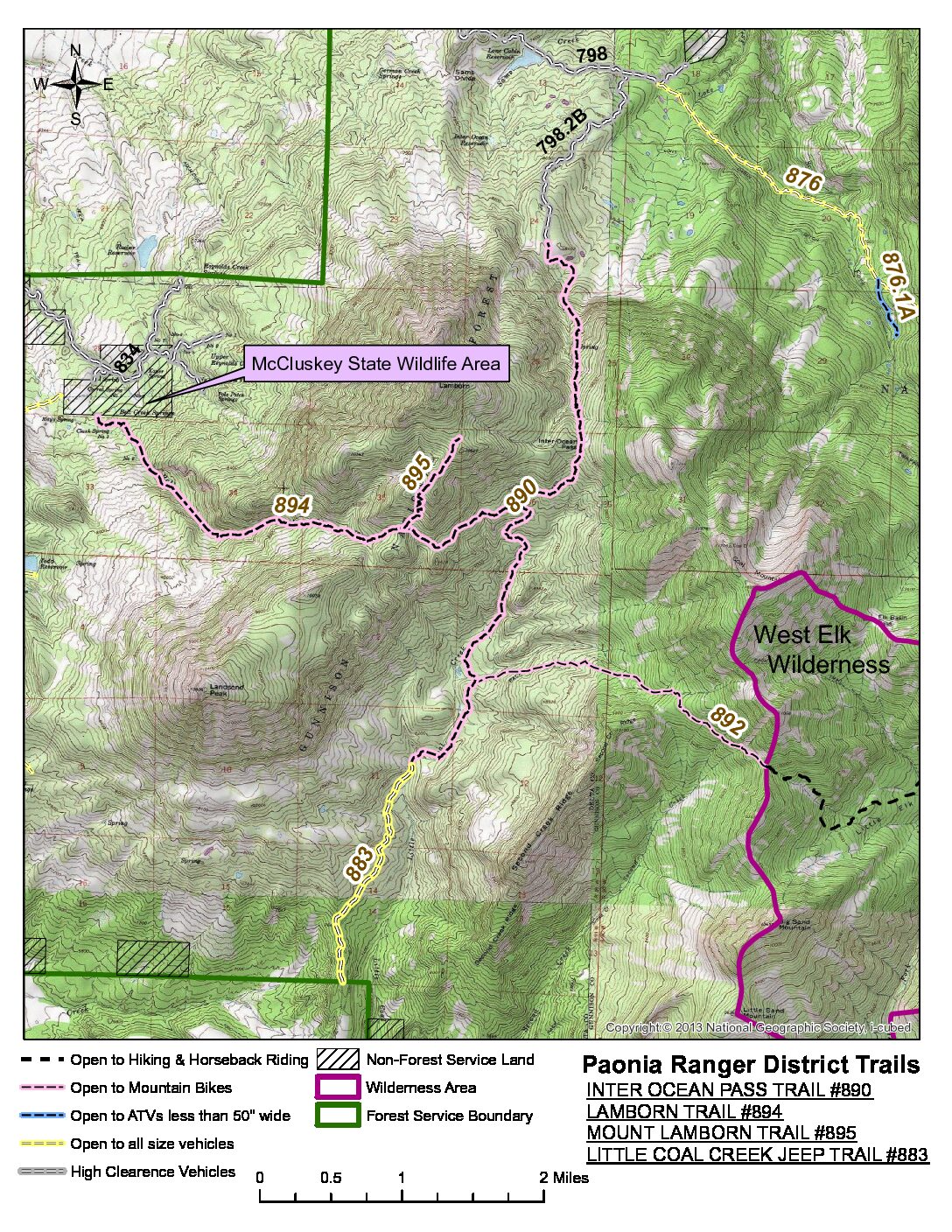
Little Coal Creek/Inter-Ocean Pass 
Overview: Enjoy hiking at the base of Mt. Lamborn and Coal Mountain, which is adjacent to the larger West Elk Wilderness. The Gunnison Public Land Initiative (GPLI) working group – as well as WSCC – is recommending Mt. Lamborn/Coal Mountain as Wilderness in the Grand Mesa, Uncompahgre, and Gunnison National Forest Plan revision process due to its remote location, wildlife habitat, and outstanding wilderness character. Besides the large elk, deer, and black bear populations here, it is also a significant lynx habitat.
Trail Description: From the Inter-Ocean Pass trailhead on the Crawford side, one can go 8 miles over the pass and down the Lone Cabin trailhead of the Inter-Ocean Pass. The Inter-Ocean trail does allow mountain biking, but no motorized vehicles. The last 1,000 foot climb to the actual Inter Ocean Pass is the most difficult section of the trail. The pass, just below Mt. Lamborn and Coal Mountain, is 9,800 feet. NOTE: this trailhead is difficult to reach with a low clearance car. COTREX
Difficulty: Moderate/Difficult. Starting elevation – 7,500 feet at the National Forest boundary. 7,960 at the Inter Ocean Pass trailhead. Maximum elevation we hike to should just be over 8,000 feet.
What to bring: Good boots, lots of water, sunscreen, extra layers, hiking poles
How to get to the trailhead: Drive to Cottonwood Creek Road towards Needle Rock and to the National Forest boundary where cars can park. The Little Coal Creek Road at this point becomes a very rough Jeep road for the next 1.5 miles to the Inter-Ocean Pass trailhead. Walk this section, instead of driving, or choose to take 4-wheel drive/high clearance vehicles to park at the official Inter-Ocean Pass trailhead.