

On July 14, 2024, the USDA Forest Service’s (USFS) Final Revised Land Management Plan for the Grand Mesa, Uncompahgre and Gunnison (GMUG) National Forests went into effect. The prior GMUG Forest Plan, which had been frequently amended and modified over the years, was first finalized in 1983!
The final revised plan is intended to guide management decisions for the next 15-20 years, across more than 3.2 million acres of the GMUG National Forests in southwestern Colorado, including many of this area’s most iconic peaks and favorite trails.
The Western Slope Conservation Center (WSCC), our members, and Coalition Partners provided substantive comments and engaged directly with USFS throughout this more than seven year process. Overall, the USFS received almost 20,000 public comments. WSCC Board and Public Land Committee members also took part in the Forest Service’s Objection process back in February of this year to address concerns with the USFS’s then-preferred alternative plan.
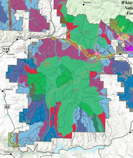
One of the top priorities for WSCC and our members was advocating for additional Recommended Wilderness in areas surrounding the North Fork Valley. Wilderness areas provide primitive recreational opportunities, wildlife habitat, and help protect clean water resources. In the original preferred alternative of the GMUG’s plan, all of these areas were omitted. Thanks in part to WSCC’s efforts, the final revised plan now includes 68,000 acres of Recommended Wilderness!
Although WSCC advocated for much larger areas of Recommended Wilderness, which unfortunately were not included in this final Management Plan, the 68,000 acres that were added as a result of the Objecion process are a welcome addition and a direct product of WSCC involved efforts.
Recommended Wilderness areas must still be officially designated as Wilderness by an Act of Congress. But in the meantime, their inclusion in the final revised plan means that they will be managed consistent with the adjacent Congressionally designated wilderness areas. Additionally, pre-existing authorized, non-conforming uses may continue in Recommended Wilderness Areas so long as they do not impair the area’s wilderness characteristics.
Beyond Recommended Wilderness, the final revised plan allocates more than one-quarter of the GMUG — 823,000 acres – as Wildlife Management Areas, where trail expansion will be capped, while providing ample opportunities to improve existing trails and expand where appropriate. Other notable aspects of the final revised plan include 771,000 acres identified as suitable for timber production, and 2.4 million acres of rangeland resources (one of the largest rangeland resource bases of any national forest in the US).
On the map below RED are the new Recommended Wilderness Areas. GREEN is Congressionally Designated Wilderness. Some color distortions are due to overlapping map layers.
Conclusion
WSCC and Coalition Partners are currently undergoing a deeper analysis of certain issues and concerns, specifically sage-grouse protections, species of conservation concern, the reasonable range of alternatives, timber suitability, and climate change impacts. Furthermore, it will be critical for WSCC and community members to remain engaged as USFS begins to move ahead with individual projects on the GMUG National Forests under the final revised plan.
WSCC looks forward to working with USFS, Coalition Partners, and our Federal, State & Local elected officials to ensure lasting protections for the areas and values we’ve advocated for throughout the GMUG planning process.
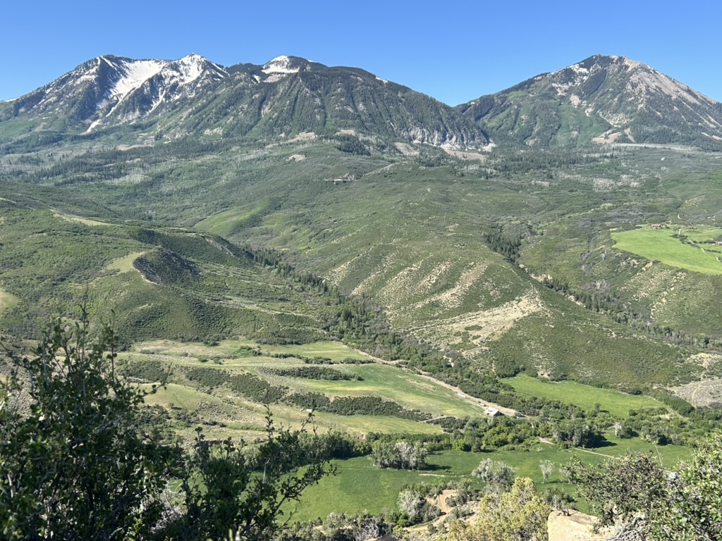
West Elk Wilderness – Lamborn Addition
In the final revised plan, 3,378 acres southeast of Paonia, nearby Mt. Lamborn, Lands’ End, and the Chain Mountains are allocated as the Lamborn Addition Recommended Wilderness. This area coincides with the northern boundary of the Upper Tier portion of the Mount Lamborn Colorado Roadless Area, from where it joins the congressionally designated West Elk Wilderness west to a ridge of Coal Mountain that is within 500 feet of the Delta County/Gunnison County line. The unit is located only in Gunnison County.
From there, the boundary continues along the south-southeast ridge that divides South Fork Minnesota Creek and Little Coal Creek until Coal Mountain. From Coal Mountain proper, the boundary continues along the ridgeline and ties back into the existing congressionally designated West Elk Wilderness. The terrain is steep, rugged, and challenging to navigate. Access is limited, making much of the area difficult to reach—which contributes to the solitude.
The Raggeds Wilderness – Munsey Creek/Erickson Springs Addition
In the final revised plan, 7,278 acres are identified as the Erickson Springs Recommended Wilderness. It is located to the northeast of Paonia and lies just west of the existing Raggeds Wilderness Area. The western boundary is formed by the Raggeds Trail. The vegetation is dominated by aspen, as well as spruce-fir, Gambel oak, and sagebrush. The southern area forms the western low-angle flanks of Marcellina Mountain, while the northern portion of the area forms the low-angle flanks of the Raggeds mountain range.
West Elk Wilderness – Soap Creek/Curecanti Addition
West Elk Wilderness – In the final revised plan, the Soap Creek, Curecanti & Dillon Mesa Recommended Wilderness adds 11,679 acres adjacent to the existing West Elk Wilderness. The core of these areas is based on the Soap Creek and Curecanti Colorado Roadless Areas. These areas were found to possess a high degree of wilderness quality characteristics with important wildlife habitat and opportunities for solitude and primitive recreation.
West Elk Wilderness – Pass Creek/Castle Addition
In the final revised plan, the Pass Creek/Castle Recommended Wilderness covers 1,748 acres adjacent to the eastern portion of the West Elk Wilderness. This area has been previously managed as the Castle Colorado Roadless Area, contributing to a high degree of wilderness quality characteristics. The southern and eastern boundaries generally run just to the north and west sides of Little Pass Creek Trail. In the northern portion the Swampy Pass Trail provides an access portal into the wilderness.
Co-Author/Photo Credits: Mike Burkley