
Terror Trail 
Overview:
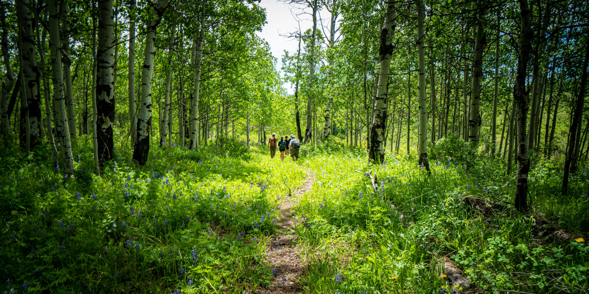
The Terror Trail travels through the Electric Mountain Recommended Wilderness that is included in WSCC’s Community Conservation Proposal and is being considered in the GMUG Forest Planning process. At 9,700 acres, aspens dominate the Electric Mountain, and this ecosystem is underrepresented within the existing wilderness preservation system. It offers outstanding non-motorized hiking and hunting opportunities – and plenty of solitude.
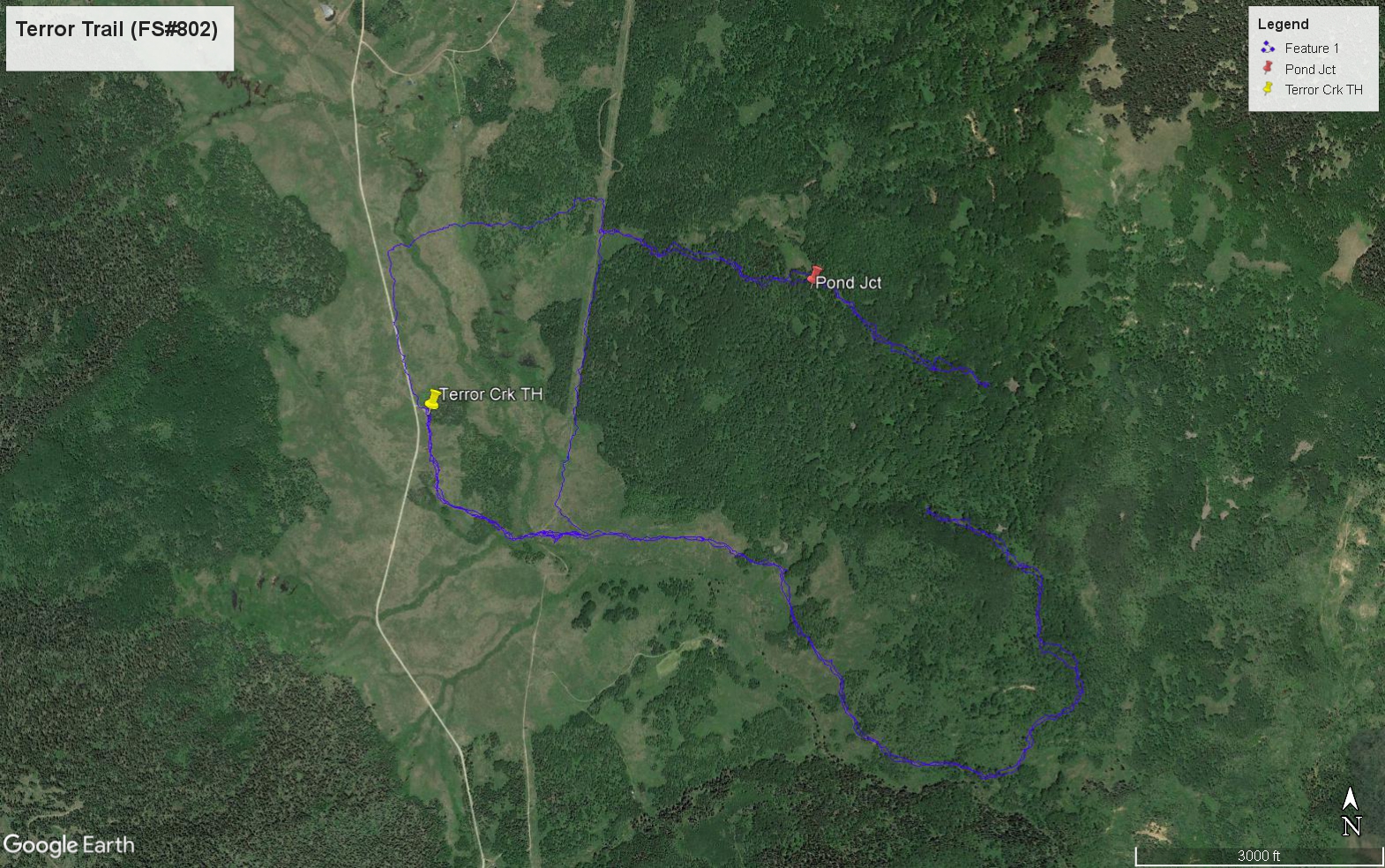
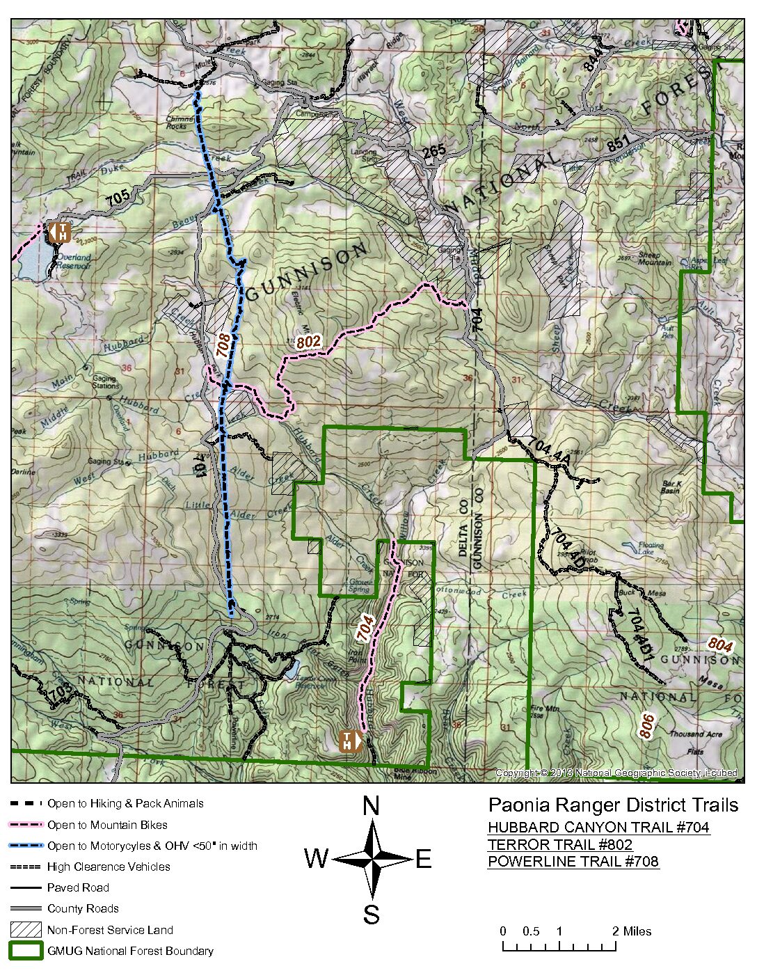
Trail Description: Follow Forest Service Trail #802. The trail crosses Electric Mountain in a west to east direction. It uses an old Jeep road that parallels Hubbard Creek for the first 2 miles. At this point, it climbs moderately up toward Electric Mountain. Aspen, with their verdant understory and abundant wildflowers, dominate the landscape with occasional Spruce and Firs heralding the future of this landscape that is dotted with boulders, moraine, and other evidence of past glaciers. The attached file shows a satellite view of 2 GPS tracks made while scouting this hike. COTREX
Where: West Terror Trail TH off of Stephen’s Gulch Road, Gunnison National Forest
Difficulty: Moderate due to the 4-mile length and 500-ft elevation change from the TH at 8,800 to about 9,300 feet at the pond. The Forest Service already cleared fells across the trail and the terrain, though it includes some roots and moraine rocks, is not very rugged.
What to bring: Good hiking boots, plenty of water, lunch/snacks, sun protection, and bug spray. Hiking poles due to descent and a possible creek crossing.
How to get to the trailhead: Drive 15-miles up Stevens Gulch Road from Paonia, which becomes Forest Road #701. The trailhead is in Hubbard Park, about 5 miles past Windy Point, at the base of Electric Mountain.
Scroll over the images to see where we are headed!
Your confirmation refers to an April 13th hike but we signed up for July 12th??